PLA11-25, trip log, East and South Greenland Explorer

by Oceanwide Expeditions

Photo gallery

Logbook

Day 1: Longyearbyen, Embarkation

Longyearbyen, Embarkation
Date: 13.08.2025
Position: 78°16.0’N / 015°24.7’E
Wind: N2
Weather: Fog
Air Temperature: +8

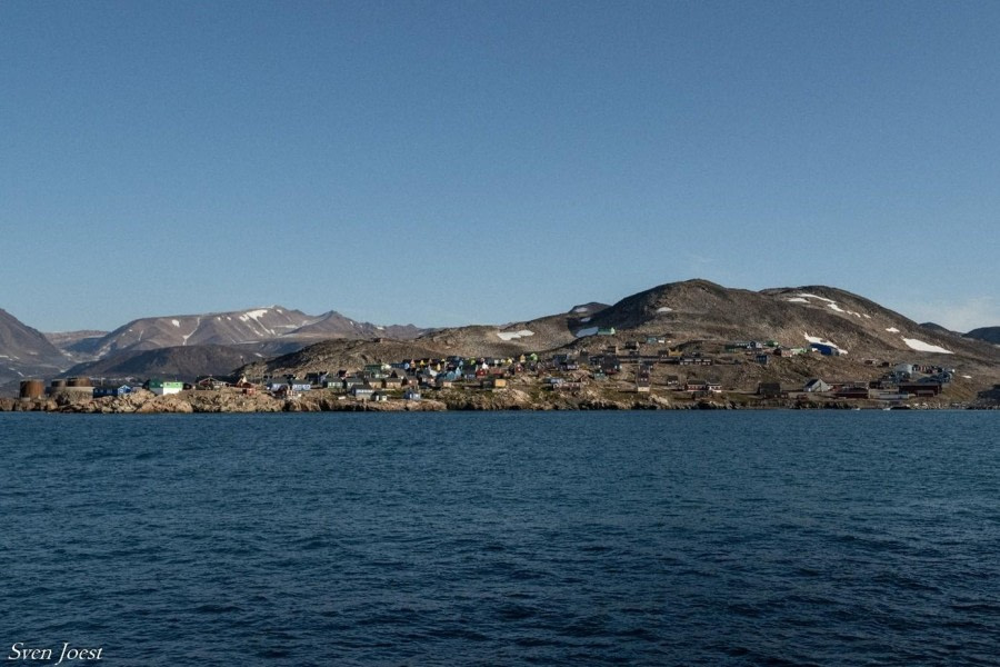
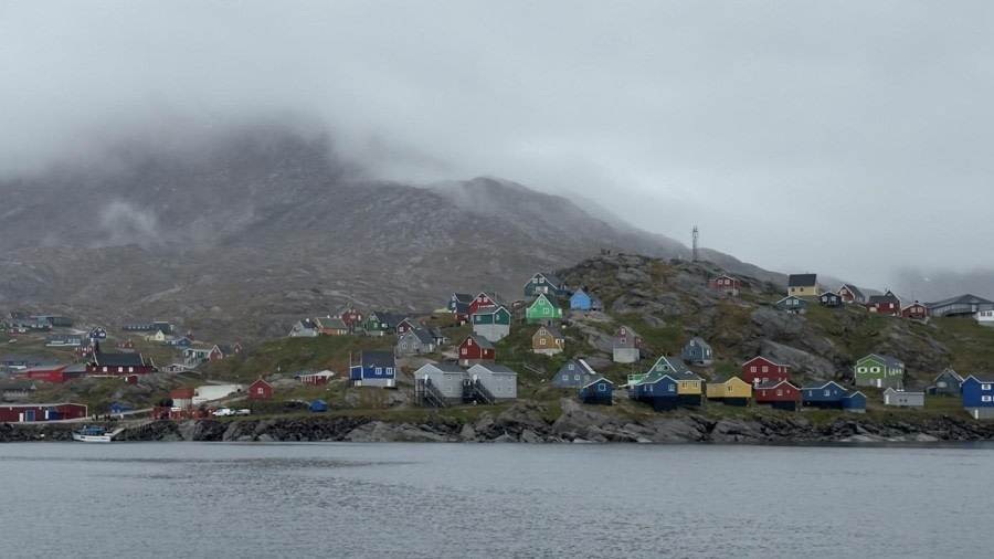
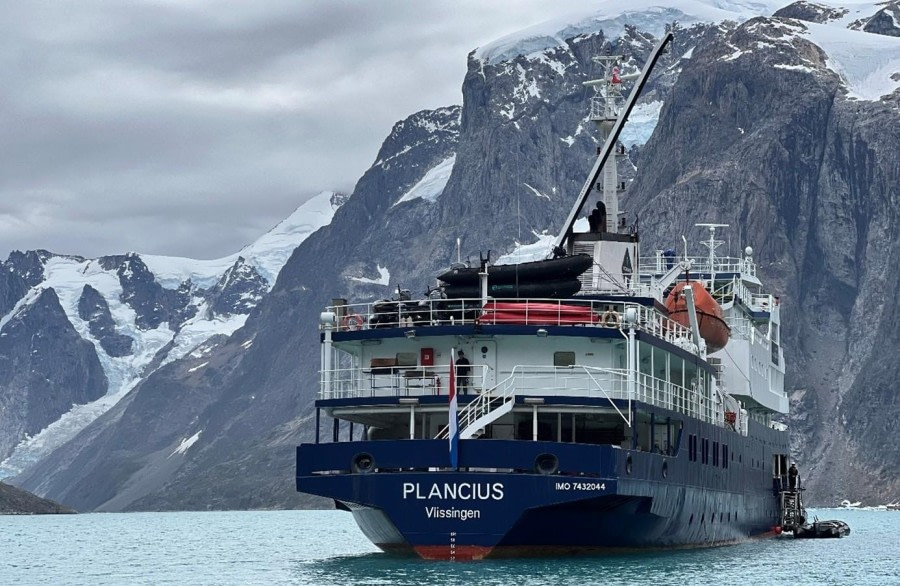
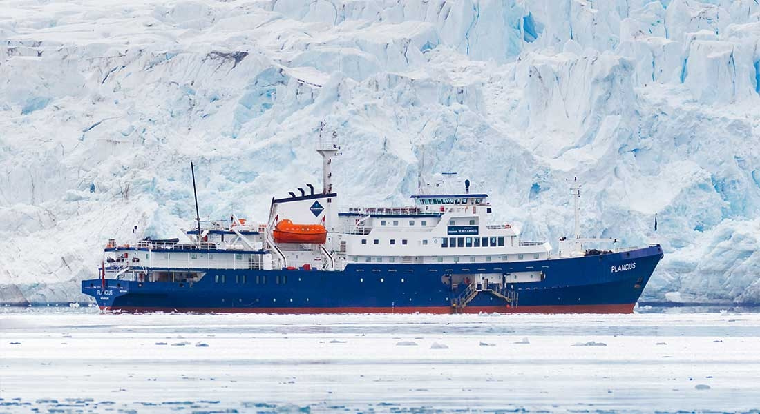
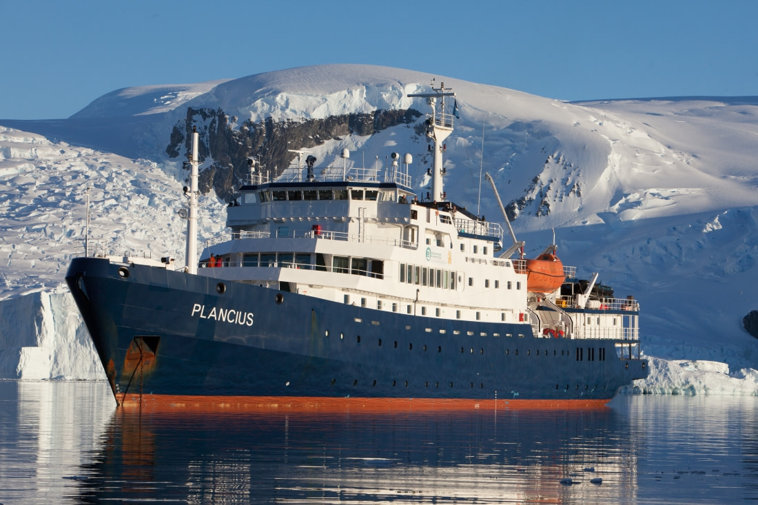
Travelers arrived from every corner of the globe—some having already spent nights soaking in the Arctic charm of Longyearbyen, others stepping off morning flights with anticipation still fresh in their eyes. By afternoon, the quay buzzed with excitement as we gathered beside the striking blue hull of Plancius, the vessel that would carry us towards and around Northeast Greenland for the next 20 days.

From four o’clock, the Oceanwide Expeditions team and crew greeted each guest with warm smiles and a sense of adventure that was contagious. Once cabins were discovered and bags unpacked, many gravitated to the lounge, where steaming cups of coffee and tea offered a comforting pause before the first official proceedings began.

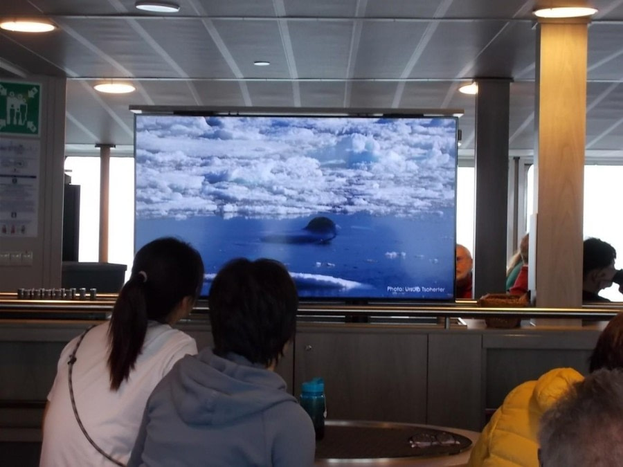
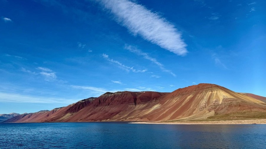
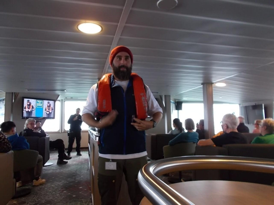
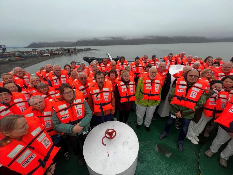
The mandatory safety briefing quickly transformed from formality into adventure. Second Officer Ward led us out onto deck, where we stood in crisp Arctic air, clad in bright orange lifejackets. Against the backdrop of rugged mountains and icy waters, we listened, half-distracted by the views, half-awed by the thought that this was only the beginning.

Then came the moment of departure. Lines were cast, and Plancius began her slow glide away from Longyearbyen. Guests gathered at the railings, cameras in hand, quietly marvelling as the settlement shrank into the distance and the wilderness unfolded before us.

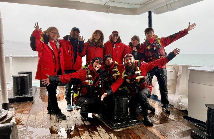
Soon after, the lounge filled with the hum of conversation and clinking glasses. Captain Levakov raised a toast, joined by our Expedition Leader, Pippa, and his dedicated team, each promising the days ahead would be filled with discovery and wonder. Dinner followed—a generous buffet that introduced us to the talents of the restaurant team, and to each other.

As twilight lingered, many chose to remain on deck, wrapped against the chill, unwilling to tear their eyes away from the stillness of the Arctic evening. Excitement mingled with exhaustion as one by one; we drifted off to our cabins, carrying with us the quiet thrill that tomorrow, the true adventure would begin.

Day 2: Day at sea towards Greenland

Day at sea towards Greenland
Date: 14.08.2025
Position: 78°01.3'N / 011°54.3'E
Wind: NE4
Weather: Cloudy
Air Temperature: +8

The crossing from Svalbard westward to the east coast of Greenland is long. So we spent today at sea. We did use the time wisely, however, and got the mandatory briefings out of the way. Without the instructions on how to treat the Arctic and its inhabitants respectfully, how to get in and out of the zodiacs safely, and what to do in case of a polar bear sighting, we would not be allowed to land.

We were then invited to listen to two lectures. In the morning, Ursula introduced marine mammals, many of which we are hoping to see on our voyage. In the afternoon, Aitana presented an overview of sea ice, promising more information on glacier ice later in the trip.

The rest of the time was spent out on the deck or in the lounge, enjoying the calm marine scenery, albeit under a grey sky, and following the flight of the different species of birds, some of Pierre explained to us during the recap. In addition, George provided us with different definitions of the Arctic and talked us through the Icelandic claim of being of eight Arctic states.

Day 3: Arriving at the pack ice of Northern Greenland

Arriving at the pack ice of Northern Greenland
Date: 15.08.2025
Position: 76°26.1'N / 009°40.3'W
Wind: NW4
Weather: Cloudy
Air Temperature: +2

The sailing through the Greenland Sea during the night was calm and smooth. The gentle movements of Plancius keeping us deep asleep. Especially as we got another extra night hour to account for the different time zone. As we had made very good progress, we had reached the pack ice edge in the early morning hours. What a beautiful moment to wake up and to look out of the window. And even more was the breakfast unique when sitting at the table while icebergs of all shapes passed by.

Even more as the sky was blue and the sun was shining. Soon after breakfast everybody was standing on deck taking in this exceptional beauty of the polar world. The ice was densely packed yet moving slightly up and down due to a gentle but visible swell. Captain Evgeny and his crew carefully steered Plancius into the ice pushing the shoals to the side. Occasionally the hull hit a piece too heavy to move easily which created a trembling movement and sound through the ship. From bow to aft.

As usual we were followed by numerous Northern fulmars sailing effortless through the air. Often at eyelevel allowing photographers to capture their unique beauty. Other birds like various skuas and guillemots were discovered. In the water harbour seals lifted their head out and small groups of harp seals swam in their typical manner while lying on their back.

Since the early morning hours, the crew and the guides were standing on the bridge and at deck to scan the white surface stretching towards the horizon. Behind we could see the dark and ragged coastline of Greenland. Of course, everybody was waiting that a polar bear was sighted. But scanning ourselves we realized how difficult it is to discover the almost white animal within the white ice spread flat on the water or piling up creating many invisible spots in the unique landscape.

Fortunately, it was quite warm. We were standing in awe and enjoyed every second. What a gift to experience. Later in the morning Andi offered an informative lecture about Kattalik, the country whose coastline was visible in the far distance.

After lunch we continued to scan while Plancius sailed southwards. Still close to the ice and despite great visibility none of the Kings of the North became visible. We enjoyed nevertheless being out on deck especially as the hotel crew surprised as with a cup of hot chocolate, a shot of rum and whipped cream. Later the wind picked up, temperature fell, and fog moved in restricting the visibility to less than 100 m. Impressive to see how quickly things can change in the Arctic.

At recap, Pippa outlined the plans for tomorrow, Ursula presented the harp seals in more depth and Aitana explained how much effort and mathematical modelling is needed to create a weather forecast. Which is most likely wrong anyways. After diner we had reached the south side of Shannon Island where we hoped to escape from the dense fog. But it was just the same as some hours ago. The fog was too dense. Oh well, we thought, the day has been unique and memorable leaving a good understanding how the home of the iconic polar bear looks like.

Day 4: Myggbukta

Myggbukta
Date: 16.08.2025
Position: 74°18.6'N / 018°04.4'W
Wind: N6
Weather: Partly cloudy
Air Temperature: +1

All of us woke up in the morning feeling excited that today is the first day where we are going to set our feet on the soil of Greenland. But this needed to wait until the afternoon since we were still making our way towards the landing site. Nevertheless, to be fully prepared for our landing the expedition team handed for everyone Muck Boots out so all of us are well equipped to hike onshore. After everyone found the right pair of boots, it was time to join Sven in the Observation lounge for a lecture about the geology of Greenland. Afterwards all of us enjoyed the views from the decks to the surrounding landscapes. Before lunch George gave a lecture as well about the Modern History of North-East Greenland. Before heading out all of us strengthened ourselves with a good lunch.

Then it was finally time to set foot on land at Myggbukta which translates to Mosquito Bay. At Myggbukta there is one of the oldest and best-preserved Norwegian trappers cabins you can find in North-East Greenland. It was built in 1922 and was used by various people through time. Afte arriving on shore we started to divide into groups of long, medium and short hikers. While the long hikers steamed off into the mountains everyone else had a look into and around the cabin before starting to walk. While everyone was hiking through the tundra some were lucky to spot up to four snow owls after gaining some elevation.

We were lucky to observe these birds for a longer period, and we assumed that there was a breeding pair with two juveniles. Others also had the chance to observe already on the first landing musk oxen from closer. While enjoying the great view from the upper plateau on the fluvial glacial plain below us we could feel the scale of the landscape we were walking in. As the time passed by it was time for us to return to the landing site. With many different first impressions of our first landing, we returned to the ship. After the recap we all went hungry to our well-deserved dinner as we sailed to our destination of the next day, Blomsterbugten.

Day 5: Blomsterbugten & Maria Ø

Blomsterbugten & Maria Ø
Date: 17.08.2025
Position: 73°25.0'N / 023°46.7'W
Wind: W1
Weather: Cloudy
Air Temperature: +4

It was an unusually early wake-up call for a Sunday morning, owed to the busy programme ahead of us, but many people were up already to look at the awe-inspiring Teufelsschloss (“Devil’s Castle”) and the colourful layering of similar rock formations all around and high above us. Overnight, the ship had made its way into Kaiser Franz Joseph Fjord.

Low clouds and a light drizzle welcomed us at Blomsterbugten (“Flower Bay”). Not dispirited by the weather, all those who came ashore, anyone from leisurely walker to mountain goat, was rewarded with sightings of Arctic hare, musk ox, and for some also a rock ptarmigan. The musk ox calves looked at us with some curiosity, which made for lovely pictures and lasting memories to take away from this encounter.

During our scenic cruise through the gigantic fjord, the Danish Sirius Patrol came aboard to check Plancius’ papers and procedures. If the ship had not slowed down for this, we probably never would have spotted three polar bears – a mother and two older cubs – swimming along the shore before coming onto land and disappearing up into a large river valley. We can expect polar bears anywhere at any time.

By the afternoon, there had also been a big improvement in the weather. Our landing on Maria Ø (Maria island) was sunny and warm. Layers of clothing quickly came off as the different groups made their ways across the island. The sunlight on the mountainsides presented the many different hues of red and yellow we had been missing in the morning.

Day 6: Alpefjord & Segelsaellskapet

Alpefjord & Segelsaellskapet
Date: 18.08.2025
Position: 72°42.2'N / 024°44.7'W
Wind: E1
Weather: Clear
Air Temperature: +6

The sky was clear as we sailed into Alpefjord where we planned a morning zodiac cruise. Even though the sun was shining, the wind was blowing very strong and therefore everyone was advised to put on an extra layer of clothing. While we were having our breakfast the deck crew lowered, one by one, the zodiacs onto the water. Soon after, the zodiacs spread into the fjord towards the wall of ice reaching into the water. It is built by the Gully Glacier and the Sefström Glacier which merge into one some distance above. As we cruised deeper into the fjord, we observed the rugged ice front where countless vertical cracks and lines of sediment rich ice created a unique appearance. The scenery of the surrounding mountains added an impressive scenery making us feel small. Especially due to the presence of the prominent Mount Pyramid reaching 2293 m into the sky. After a windy but stunning zodiac cruise we all went back onboard and sailed out of Alpefjord towards our afternoon destination in Segelsälskapetfjord.

After lunch we reached the fjord sailing along a mountain called Berzelius Bjaerg. The 1500 metre rock face visible above the water is made of layers of various coloured sedimentary rocks creating a breathtaking scenery. Finally, we set foot on land and walked the short distance to the spot where the layered rocks entered the water. Reaching a depth of up to 600 m in the fjord and reappearing, although not as spectacular, on the other side.

The multi coloured striped looking sedimentary rocks of mudstone, limestone, sandstone and dolomite are part of the Eleonore Bay Supergroup Basin which was deposited 900 to 600 million years ago and is reaching at some places up to 14 km of thickness. By now we all became very captivated by the unique and beautiful geology. We had plenty of time to explore it while the long and medium hikers went to explore the surrounding areas. With a stunning view from the high point over the valley with the lake and mountains in the background some spotted a single musk ox as well. After our beautiful hikes we arrived back at the beach to go back onboard Plancius. The truly memorable day ended with a beautiful evening while we were making our way to Vikingbukta.

Day 7: Fleming Fjord

Fleming Fjord
Date: 19.08.2025
Position: 72°12.2'N / 023°25.9'W
Wind: W3
Weather: Partly cloudy
Air Temperature: +7

We woke up to a spectacular morning in Fleming Fjord, calm weather, crisp air, and blue skies that made the landscape shine. After breakfast, we went ashore for a beautiful walk. There were three options for the day: long, medium, and short hikes – all of which offered something special.

The terrain was open and welcoming, scattered with vibrant Arctic flowers in full bloom. The long hikers ventured further inland, where they were rewarded with breathtaking views of the river canyon, a striking feature carved through time. The canyon walls framed the landscape like a painting, and the light played beautifully on the layered rocks.

The medium and short hikes followed gentler paths along the ridges and moraines, offering peaceful views and a chance to appreciate the quiet detail of the tundra, tiny blooms, lichen-covered rocks, and the slow rhythm of the Arctic.

In the afternoon, we lifted the anchor and continued our journey northward. While underway, Pierre gave a fascinating lecture on polar bears, diving into their biology, behavior, and the challenges they face in a changing Arctic. George followed with a talk on the modern history of Northeast Greenland, tracing the human stories that have unfolded in this remote region over the last century – from hunting stations to scientific expeditions and territorial claims.

A day full of beauty, stories, and stillness, Fleming Fjord reminded us just how layered and alive this landscape is.

Day 8: Vikingbukta & Northwest Scoresby Sund

Vikingbukta & Northwest Scoresby Sund
Date: 20.08.2025
Position: 70°23.3'N / 022°31.7'W
Wind: NE3
Weather: Clear
Air Temperature: +8

The day began with sunshine spilling over the fjord as Pippa, our expedition leader, gently woke us for an early Zodiac cruise. Scoresby Sund, the world’s largest fjord system, lay calm under the bright Arctic light. Before we entered the ice of the Brede Glacier, our eyes were caught by something extraordinary along the shore: the first columnar basalt formations. Created by the slow cooling and contraction of ancient volcanic lava flows, they rose in striking geometrical patterns, often hexagonal, forming surreal cliff walls that looked as though carved by the hand of a sculptor. The contrast of these dark volcanic columns against the shimmering ice set the stage for the wonders that would follow.

From there, we cruised deeper into the ice. The Zodiacs threaded their way through gleaming icebergs and clusters of brash ice that crackled softly under our hulls. It felt adventurous and raw, as if we were navigating through a frozen maze. Then came Pippa’s voice over the radio—she had spotted a polar bear resting on the glacier’s moraine. Hearts raced as all Zodiacs carefully gathered, engines silenced. The bear lay stretched out in regal stillness, its creamy coat glowing in the sun. Suddenly, another bear appeared, this one swimming powerfully among the ice floes. The sight of its massive body cutting through the freezing water left us in awe. From our position, we had a perfect view: the resting bear high above and the swimmer carving its way below.

After returning to the ship, lunch tasted all the better with the thrill of the morning still echoing in our minds. In the afternoon we cruised northward, weaving past monumental icebergs around Milne Land to the east. Their sheer scale and sculptural beauty were breathtaking. Later, Sven held a lecture on geomorphological phenomena, explaining how glaciers, erosion, and ancient volcanic activity have shaped this immense landscape.

The day closed with pure magic. As we finished dinner, the sun descended slowly, painting the icebergs in glowing gold and crimson. The mirrored waters caught every shade, enhancing the drama of the Arctic stage. We ended the day exhilarated and grateful, knowing we had witnessed nature’s artistry in its rarest form.

Day 9: Rypefjord & Harefjord

Rypefjord & Harefjord
Date: 21.08.2025
Position: 70°58.5’N / 026°17.5’W
Wind: W4
Weather: Clear
Air Temperature: +10

We began the day with a morning landing in Rype Fjord, under calm, warm conditions and endless blue skies. Once again, the weather was on our side, making the landscape glow with late summer light.

Hikers set off in all directions, with options for medium, long, and, today’s special, a day hike crossing overland from Hype Fjord to our afternoon landing site in Hare Fjord. This full-day traverse offered an incredible experience: walking through untouched Arctic terrain, tracing the subtle shifts in geology and vegetation as the group moved from fjord to fjord.

Meanwhile, those who stayed on board enjoyed a stunning transit around the headland. The views from the ship were unbeatable, steep cliffs, dramatic rock faces, and a stillness that made every ripple on the water feel significant.

In the afternoon, we reunited in Hare Fjord, where the tundra was ablaze in autumn colour, deep reds, golden yellows, and rust-toned mosses, set against the backdrop of towering icebergs grounded in the bay. The contrast was almost surreal: warm, earthy tones on land and gleaming, frozen giants afloat just offshore.

To top it all off, we were lucky to spot a group of musk oxen grazing in the distance. Their shaggy silhouettes moved slowly across the hillside, perfectly framed by the afternoon light. It was a powerful reminder of the wildness and resilience of life in this remote landscape.

It was a day of movement, connection, and unforgettable beauty, crossing from one fjord to another by foot or by sea, under skies that felt painted just for us.

Day 10: Bear Islands & Sydkap

Bear Islands & Sydkap
Date: 22.08.2025
Position: 70°54.4’N / 026°56.0’W
Wind: W1
Weather: Clear
Air Temperature: +7

Today’s expedition adventure started at the Bear Islands (Nannut Qeqertaat) where a polar bear has been shot during the East Greenland Expedition (1891-92) lead by Carl Ryder. The group of islands of various sizes and heights were creatively named I – XI. Majestic mountains created a scenic and impressive background for amazing photos. Especially the Grundvigskirken pinnacle whose vertical wall of crystalline rock raised 1977 meter into the air. The unique shape of the top reminded past visitors of the Grundvigs church in Kopenhagen, thus its name.

Soon after breakfast ten zodiacs left the gangway heading straight towards various gigantic icebergs whose surfaces sparkled in the morning sunlight creating artistic sculptures of ice and light only nature is capable of. Slowly gliding through the calm sea we got plenty of time to capture the various faces of the iceberg from various perspectives. These giants who have been quite likely broken off in the far North of Greenland have been carried south with strong currents eventually stranding in the fjord system.

Although wildlife was scarce, we did discover a few seals and an eider duck with its chick. The surfaces of the islands were mostly barren rocks although some hints of green suggested that vegetation is slowly growing at places protected from the harsh Arctic climate. We thoroughly enjoyed the zodiac cruise offering enough time to take in the beauty of the Bear Islands.

Back on board we shared experiences, views and emotions with each other. Looking at the various photos ion the cameras’ screens it was impressive how diverse they were considering that we had all visited the same place. As Plancius slowly headed north icebergs of various shape and sizes passed through the windows leaving a sense of surrealism.

After a relaxing break we landed at Sydkap where we first visited the amazingly well-preserved remains of several winter houses from the Thule people. Gathering around Frigga we got the information needed to read the depressions and raisings in the ground. Today covered in soil and gras. During our hike through the boggy and soft tundra we got to a small lake where a red throated diver landed near its chick. Unfortunately, it did not feed the fish it carried in its beak during our observation. From a higher viewpoint we could take in the huge space of Hall Bredning a wide part of the Scoresbysund. Here hundreds of large and small icebergs float or are stuck to the seafloor. Some remain here for years. The long hikers had gained even higher ground and encountered some musk ox.

Meanwhile the leisurelies explored the beach line where a rather unusual plant grows in great numbers. The green and thick leaves of the Roseroot (Rhodiola rosea) turn pinkish reddish in fall offering unique motives for plant photographers.

Before we headed back on board some brave guests among us ran into the cold Arctic water. Surely most of them got out just as fast if not even faster. Congratulations to you braves for your successful polar plunge.

Another unique day ended after a tasty diner in the lounge or on deck as the scenery around us remained breathtaking. Meanwhile Plancius sailed slowly through the still bright night to bring us to tomorrow’s destination.

Day 11: Ittoqqotoormiit & Hurry Inlet

Ittoqqotoormiit & Hurry Inlet
Date: 23.08.2025
Position: 70°43.6’N, 024°21.1’W
Wind: E1
Weather: Partly cloudy
Air Temperature: +6

The morning was beautiful as we woke up and saw the first settlement of our journey after leaving Longyearbyen on Svalbard. On the rocky but gentle hill in front of us everyone saw the settlement of Ittoqqortoormiit. This remote settlement is the northernmost settlement on the east Greenland coast and has numerous colourful houses. After breakfast, we were shuttled towards the little harbour.

After arrival we could freely roam around the place and meet the local people in the community centre where we were also able to try musk oxen meat. Furthermore, a local family invited us for coffee and cake into their house which was a great and warm welcome. At 10 o`clock many attended the release of the weather ballon which is being done everyday. At 11 o`clock many attended the dog feeding and some cuddled with the husky puppies. Otherwise, it was a very relaxing morning with locals driving on their quad bikes. Otherwise, some of us looked inside the local church.

Around noon it was time to leave the settlement as we headed towards Hurry Inlet. While it initially did not look to good with fog around the fjord, we were lucky enough that our landing site was free of fog and low clouds. On the way to the shore, we saw already the sandy beach followed by a hilly landscape. The long hikers went all the way into the backcountry and were lucky enough to spot two blue foxes. The medium hikers walked through the landscape was riddled with moors and large boulders. The leisurely group meanwhile were walking mainly along the coastline picking up a good amount of trash lying on the beach.

Furthermore, they spent in the end more time on the floor lying than walking. That was due to the excitement of using Ursulas magnifying glasses to explore the small plants and mosses on the ground. After the long and eventful day everyone was ready to go back to Plancius to enjoy a good dinner and some rest. As we were having dinner, we sailed to our next destination in the morning which was Rømer Fjord.

Day 12: Rømerfjord

Rømerfjord
Date: 24.08.2025
Position: 69°48.0’N, 022°00.6’W
Wind: NE5
Weather: Overcast
Air Temperature: +2

This morning, we were woken up by our expedition leader Pippa as we had entered Rømerfjord, a fjord system South of Scoresby Sund. The day was overcast and there was a little bit of wind, but that did not stop our expedition team from heading out early in 4 zodiacs to scout the fjord for possible polar bears. And sure enough they found a mother and a cub on a hillside. Pippa then decided to start our day with a zodiac cruise in order for all our guests to see these bears. After we had all embarked our zodiacs, we moved towards the location where the bears had been sighted and we were able to observe them as they climbed the hill and disappeared in the distance. What an incredibly good start of the day. We had already sighted so many polar bears in Greenland.

We then continued our zodiac cruise to the end of the fjord where we saw the glacier. After that Pippa decided to do a short perimeter landing on the hot springs site. The guides created a perimeter around the landing site and we were able to walk around freely to observe the beautiful rock formations, some of them made up of basaltic structures, as well as the hot springs and the interesting vegetation. This is a popular hunting site for the local inhabitants, as we could see by the many bones scattered all around the landing site.

We then all returned back to Plancius for our delicious lunch, and the afternoon was spent repositioning our ship further South, as we still had a long way to cover for our next activities on the next day. The sea was a little rough so we spent most of the afternoon inside listening to very interesting lectures, until it was time again for our daily recap, followed by our dinner. Another amazing adventurous day on our East Greenland trip.

Day 13: Nansen Fjord

Nansen Fjord
Date: 25.08.2025
Position: 68°21.1’N / 027°59.7’W
Wind: NE5
Weather: Rain
Air Temperature: +4

We began our day shrouded in mystery. In the early morning hours, thick fog blanketed Nansen Fjord, casting a ghostly silence over the still waters. Named after the legendary Norwegian explorer Fridtjof Nansen—scientist, diplomat, and pioneer of Arctic exploration—the fjord is flanked by soaring, rugged mountains that rise abruptly from the sea. As Plancius cautiously made her way deeper into the fjord, the fog began to lift, slowly revealing a dramatic landscape of towering peaks, glacial valleys, and scattered sea ice.

Then came the moment we’ll never forget. Just before breakfast, a polar bear was spotted on the ice. It was calm, even regal in its slow movements. Cameras clicked, binoculars shifted, and a hushed reverence fell over everyone on deck. For two and a half magical hours, we watched in hushed awe as this iconic predator—serene and seemingly unbothered by our presence—shifted, stretched, and occasionally glanced our way.

By late morning, we began to leave the fjord, and as we did, the weather rewarded us with breathtaking show. Veils of fog parted to reveal the colossal scale of the mountains and the snouts of distant glaciers, all glowing in angled Arctic light. It was hard to look away.

Later, as we sailed southward in open waters, just as lunch was being served, the excitement flared again: orcas! A pod appeared alongside the ship, their sleek black fins cutting effortlessly through the waves. We rushed out to the decks to watch as they surfaced, breathed, and vanished again in elegant rhythm. Seeing such powerful, intelligent creatures in the wild was a stirring experience.

To round off the day, Ursula gave a fascinating talk on Arctic Whale Ecology—made all the more powerful after witnessing two apex predators in their natural environment: the polar bear and the orca.

What a day. The kind of day that reminds us why we came to this remote corner of the world in the first place.

Day 14: Tasiilaq

Tasiilaq
Date: 26.08.2025
Position: 66°17.8’N / 034°07.6’W
Wind: NE2
Weather: Overcast
Air Temperature: +5

Today we transited by ship towards Tasiilaq during the morning. We entered the beautiful, protected bay with very calm waters from where the name Tasiilaq comes from, which means „like a lake“. At about 11 am we disembarked, and Pippa welcomed us at the pier of Tasiilaq. From there, there were many things we could visit. Some of us went straight to the local museum which was located in a building which looked like a little church on the top of the first hill. There, we were able to go through the past history of Tasiilaq and to see old traditional hunting artifacts, as well as narwhal and walrus tusks. There was also a small souvenir shop where some of us bought postcards, local jewelry, or even the typical Tupilak. The weather was overcast, and it rained a little bit every now and then, but it was still very enjoyable to walk around in this little town and to see what everyday life looks like in a Greenlandic town.

We were able to visit the community centre, the local supermarket which seems to be the local hub, and we could see the local school and kindergarten. Some of us went back to the ship in between to have some savoury snacks during the afternoon, but most of us made it back out to go to the 5 pm cultural event at the community centre. There, the local community welcomed us and we witnessed an amazing performance by the local choir, as well as drums and dance. During the day some of us also went to the dog kennel where we saw the local Greenlandic dogs and there were also puppies that everybody wanted to take back to the ship. After the cultural event, we all made our way back to the ship where we had our daily recap and our lovely dinner. Another wonderful day in Greenland.

Day 15: Nansen Bugt & Umiivik

Nansen Bugt & Umiivik
Date: 27.08.2025
Position: 64°38.1’N / 039°10.9’W
Wind: W2
Weather: Rain
Air Temperature: +6

Today was not just another day of Arctic exploration—it was a day rooted in polar history. Our mission was clear and inspiring: to follow in the footsteps of the legendary Norwegian explorer Fridtjof Nansen, whose daring 1888 expedition across the Greenlandic ice cap became a milestone in polar exploration.

We sailed into Nansen Bugt, a bay named in honour of Nansen, located along the rugged southeastern coast of Greenland. Early in the morning, the expedition team called us to board the Zodiacs for a cruise around the glacier front. The conditions were ideal: crisp air, calm water, and the sun illuminating the icy landscape.

Not long after we set off, the team spotted a minke whale, one of the smaller baleen whales, gracefully surfacing near the boats. We paused to watch it swim among the scattered sea ice—an unforgettable moment. From there, we cruised through towering icebergs, sculpted into fantastical shapes by wind and water, on our way to the glacier front of Storstrømmen Glacier, one of the major glaciers draining the Greenland ice cap into Nansen Bugt.

After returning to Plancius for lunch, the day’s second chapter unfolded. The team had planned two historic landings. First, we landed at a site where we could physically touch the Greenland Ice Cap—a massive, ancient body of ice covering roughly 80% of the island. It was a surreal experience to stand at the edge of this vast, frozen world.

The second landing was even more symbolic. We stepped ashore at Umiivik, the remote bay from which Nansen and his team of five men launched their pioneering crossing of the ice cap. In the afternoon, George gave a fascinating lecture about Nansen’s journey, providing context to the courage, planning, and endurance it took to undertake such an expedition in 1888.

Both landings offered stunning views into the fjords and ice-covered plateaus beyond.

As the day came to a close, we gathered in the lounge for our daily recap, reflecting on the significance of where we’d been. Over dinner, the conversations lingered on Nansen, ice, and history—memories we will carry far beyond Greenland.

Day 16: Skjoldungen Fjord & Dronning Marie Dal

Skjoldungen Fjord & Dronning Marie Dal
Date: 28.08.2025
Position: 63°44.7’N / 039°56.1’W
Wind: N6
Weather: Overcast
Air Temperature: +5

That morning, we enjoyed the rare luxury of being able to sleep in — a true indulgence on an expedition cruise. The silence of the early hours was gently broken by the cheerful voice of our expedition leader, Pippa, calling us to start the day. Rested, we left our cabins and stepped outside to marvel at the majestic fjords of Skjoldungen.

Skjoldungen, an uninhabited island off the southeast coast of Greenland, unfolded before us in a panorama of hanging glaciers and jagged peaks. These steep fjords had been shaped over millennia by the retreating ice and now form a dramatic backdrop where the raw power and elegance of nature meet. The water was mirror-smooth, reflecting the snow-covered cliffs like a perfect mirror. We spent the entire morning on deck, in awe of the landscape, cameras clicking and binoculars scanning every ridge and crevice.

After a hearty lunch and a brief midday briefing, we got ready for a hike in the Dronning Marie Dal area, a remote valley at the northwestern tip of Skjoldungen Island. It was a wonderful feeling to be walking on the tundra again — the springy moss beneath our feet, scattered wildflowers, and ancient rocks under our boots. Many of us discovered the tart, earthy taste of crowberries, easily plucked from the low shrubs. A true Arctic delicacy!

Later, during our daily recap as we cozily reflected on the day's experiences, we were suddenly interrupted — not by radio interference, but by Pippa’s excited announcement. The captain had spotted something extraordinary. We rushed to the outer deck and arrived just in time to see a mother polar bear with her two cubs climbing up a steep slope. Against the stark backdrop, their creamy fur glowed in contrast to the rocks. It was a moment of silent awe and untamed wilderness — a rare and humbling encounter.

This sighting was a spectacular conclusion to a truly unforgettable day in Greenland.

Day 17: Timmiarmiit Ø

Timmiarmiit Ø
Date: 29.08.2025
Position: 62°49.5’N / 041°14.9’W
Wind: N3
Weather: Overcast
Air Temperature: +1

Today, we were once again blessed with beautiful weather—clear skies over Timmiarmiit Ø, a rugged island group on the remote southeast coast of Greenland. As so often in this wild and unpredictable region, we didn’t know what the day would bring. But soon the expedition team picked us up, and it turned out we were in for an exciting combination of landing and Zodiac cruise.

First, we landed on one of the islands, where we visited the remains of the Thule culture. The Thule people, ancestors of today’s Inuit, lived in the Arctic between the 9th and 15th centuries. They were expert survivalists, known for their ingenuity, tools, and deep connection with nature. The visible stone foundations and traces of ancient settlements offered a fascinating glimpse into their way of life.

Afterward, we continued by Zodiac into an adventurous landscape of ice, filled with shimmering icebergs and crunching sea ice. The silence and beauty of the surroundings created a peaceful, almost meditative atmosphere.

Another highlight came as we sailed out of the bay: we spotted three humpback whales moving gracefully and calmly between the drifting ice. It was a quiet, majestic moment that left us all in awe as we stood on deck.

We enjoyed lunch, followed by a fascinating lecture from Pippa on whaling in the Arctic—a subject that links past to present. She spoke about the history of commercial whaling, the devastating effects on whale populations, and the cultural significance of whales in the Arctic.

As if the day hadn’t already offered enough, the team soon spotted a large group of pilot whales near the Plancius. These highly social toothed whales swam calmly around our ship, allowing for close and unforgettable observation.

But the true highlight came as we sailed out of the bay: we spotted three humpback whales moving gracefully and calmly between the drifting ice. It was a quiet, majestic moment that left us all in awe as we stood on deck.

In the evening, we gathered in the lounge for our daily recap, sharing stories and reflections. Then we sat down to dinner, grateful for another extraordinary day in Greenland, filled with nature, history, and the unexpected magic of the Arctic.

Day 18: Prins Christian Sund & Herjolfsnes

Prins Christian Sund & Herjolfsnes
Date: 30.08.2025
Position: 60°54.7'N / 042°06.6'W
Wind: W2
Weather: Clear
Air Temperature: +8

Prins Christian Sund, too, was an entirely new place for the Plancius to sail through. So the captain entered the long and narrow fjord at daybreak to supplement the bridge’s array of navigational instruments with the invaluable power of eyesight. And to be fair, who wants to investigate a new place without being able to see anything! Ahead of us lay a 100-km long ship’s cruise with towering mountains made of granite and polished by ceaseless glaciers into invitingly rolling rocky ridges. At its narrowest, the sound was 500 m wide while at the same time looking down on us from height of around 1300 m. Far from sailing in a straight line, the officers needed to navigate a few surprisingly sharp bends, behind each of which could lie a hanging glacier, large bearded seals sunbathing on small pieces of floating ice, a hitherto unseen bird species… or all of the above.

As the sun rose, we spotted navigational marks, a few hunting cabins here and there, a small sailboat travelling at the same speed and in the same direction as us. After all those days on the scantily inhabited east coast, we were definitely nearing the busier west coast. A last turn around the tiny island Nunarssuaq and we caught our first glimpse of the Labrador Sea.

During lunch the modern settlement of Frederiksdal came into view but the destination for our afternoon landing lay across the bay to the west. The attractions at Herjolfsnes (Ikigait) were the ruins of an early Norse settlement founded by Herjolf Bardsson in the late 10th century. It is believed to have lasted some 500 years. We could easily discern the former church and church yard eroding into the western shore. We were also quick to make out the ruins of the large longhouses, before we set off on our various hikes. The unexpected heat and the zillions of flies were getting to us, as we traversed the richly vegetated valley. So we were all the more thankful for the strong, if somewhat chilly wind on the rocks along the shore that did away with the insects. At least for a short while.

Day 19: Alluitsoq & Unnartoq

Alluitsoq & Unnartoq
Date: 31.08.2025
Position: 60°03.6'N / 045°12.7'W
Wind: SE2
Weather: Fog
Air Temperature: +5

A small handful of people was out and about when the sun began its climb behind the mountain chain framing the fjord, witnessing vibrant colours in an otherwise dark sky. Ahead of Plancius were a few electric lights, and we wondered if this was already Lichtenau (Alluitsoq), of which we had been told that it may be entirely deserted. We passed the lights. It was not yet Alluitsoq.

When we did land in the beautiful natural harbour at the foot of a decidedly green slope sprinkled with buildings in various states of decay, we were alone. The original German mission founded in 1774 by a Moravian missionary and five families was for a time the biggest permanent settlement in Greenland and played a central part in the colonization of Greenland. In 1900, the mission was surrendered to the Lutheran Church of Denmark and the place gradually lost importance until the population was encouraged to settle elsewhere in the 1990s. The last of its permanent inhabitants died in 2022. He is buried in the local graveyard. In three different hikes, we explored the material remains of a long, dynamic human history while at the same time valuing the quiet that holds the area captive today.

After lunch and a short transit further, the landscape and scenery had changed yet again from the lush slope that was somewhat difficult to walk to the more open tundra at Unnatoq – “the hot place”- the site of hydrothermal activity and hot springs. Upon arrival in the fjord, we spotted two eagles. After separating into the usual three hikes, some of us were lucky to get a better view of the impressive birds of prey in full flight. All three hikes had the opportunity to pass by the hot springs, which were at a very pleasant temperature, and to spend a lengthy amount of time relaxing in the pool or at least at the edge of it. Whether we were in the water or not, the hotel management had thought one step ahead, prepared some hot chocolate to be taken ashore and treating everyone who wanted to some Bailey’s and whipped cream as well. Meanwhile, large icebergs were slowly making their way out of the fjord and provided that special detail in everyone’s photographs of the jovial event.

We felt the first drops of rain on the shore and the weather was clearly taking a turn for the worse. Nevertheless, the joviality continued on the back deck, where the galley and the stewards had once more prepared a BBQ. The keen dancers among us could not wait for the first tables to be cleared out of their dancing ways.

Day 20: Itilleq & Igaliku & Qassiarsuk- Brattahlíð

Itilleq & Igaliku & Qassiarsuk- Brattahlíð
Date: 01.09.2025
Position: 60°34.8'N / 046°27.4'W
Wind: SE2
Weather: Fog
Air Temperature: +5

Rain! If one word were to describe our morning, it would be rain. Pippa had forecasted it during yesterday’s recap, but after the good weather we had been having all trip long, we were not quite willing to believe it. The initial light drizzle got increasingly heavier as those who wanted to walked from our landing below the cattle and sheep farm of Itilleq along the 3.8-km long King’s Road (so called after the visit of the Danish king back in the 1950s) toward Ikaliku. Not everyone stayed dry or warm, but the detrimental weather did not dampen our spirits.

The attraction at Igaliku are the ruins of Gardar, the former seat of the Norse bishopric and the site of Greenland’s first Christian cathedral dating back to the early 12th century. A local guide called Bent – also not thrown off by the relentless rain – joined the walk across the headland and gave us a tour of the beautiful modern church (thankfully from the inside), the original house and graves of the founders of today’s settlement and, of course, the archaeology of the old bishopric and cathedral. By the time he got to the cow byre – large because meant to show off – Pippa suggested a swift return to Plancius in order to dry out and warm up. It was great to experience this part of the Kujataa cultural landscape, a designated UNESCO World heritage site, but it was also great to have a hot drink back on board.

There were barely any dry spots on our outer garnets to be seen yet, when the next adventure was waiting for us in the afternoon. Not surprisingly, some opted to stay in the cosy lounge close to the coffee machine, but the majority very much enjoyed their walk around the settlement of Qassiarsuk. Again, this is a place of global historical importance and also oart of the UNESCO World Heritage site. At so-called Brattahlid, Old Norse for Steep Slope, Erik the Red founded his home stead and his wife Thjodhild converted to Christianty. Accordingly, reconstructions of a Norse longhouse and Thojdhild’s church dating to 1000 AD can be visited. Since the rain had somewhat subsided – or maybe we had just got used to it – we were also at leisure to wander around the original stone ruins or walk up to the statue of Leif Erikson, who naturally looks towards the East American coast. The little café and souvenir shop was open and gave us welcome chance to purchase a fitting memento on our last full day of the trip.

We also visited the Otto Frederiksen Museum, named after a local historian who preserved knowledge about Norse and Inuit life in the region. The exhibits offered a deeper look into the cultural layers of this unique place.

Back on Plancius, we returned our beloved muck boots, gathered in the lounge for the Captain’s Farewell, and enjoyed our final plated dinner. What a journey it has been.

Day 21: Final Farewell – Disembarkation Day aboard Plancius, Narsarsuaq

Final Farewell – Disembarkation Day aboard Plancius, Narsarsuaq
Date: 02.09.2025
Position: 60°57.6’N / 045°39.7’W
Wind: SE2
Weather: Clear
Air Temperature: +3

We woke for the last time to the familiar sound of Pippa’s voice over the intercom, a voice that had become part of our daily rhythm over the past three weeks. Outside our cabin doors, our bags waited silently to be carried ashore by the expedition team. As we gathered for one final breakfast, the air was filled with quiet conversation and reflective glances—no one quite ready to let go.

We shared heartfelt goodbyes with the dining room crew, whose warm smiles had greeted us each day, then made our way down to the gangway. Stepping off Plancius—our floating home for the past 21 unforgettable days—was surreal. The ship had carried us safely through some of the most remote and breathtaking corners of the planet. And now, it was time to part not only from the vessel, but also from the new friendships that had formed on deck, in Zodiacs, and over dinner.

How can one begin to describe all that we’ve witnessed? The endless ice, the towering cliffs, the stillness of polar silence. Whales, glaciers, geological wonders, and stories—etched forever in our memories. We’ve had the rare privilege of traveling to the far edge of the world, where nature rules in all its raw, unapologetic beauty.

Perhaps the words of Sir David Attenborough come closest:

“It seems to me that the natural world is the greatest source of excitement; the greatest source of visual beauty; the greatest source of intellectual interest. It is the greatest source of so much in life that makes life worth living.”

As we stepped ashore and looked back one last time, it wasn’t just a ship we were leaving—it was a chapter of our lives, now closed, but impossible to forget.

Details

Tripcode: PLA11-25
Dates: 13 Aug - 2 Sep, 2025
Duration: 20 nights
Ship: m/v Plancius
Embark: Longyearbyen
Disembark: Narsarsuaq

Have you been on this voyage?

Aboard m/v Plancius

Our most longstanding vessel, Plancius is a classic choice for some of our most popular polar voyages.

More about the m/v Plancius »
Loading